TruckTrix® Path

TruckTrix® Algorithm

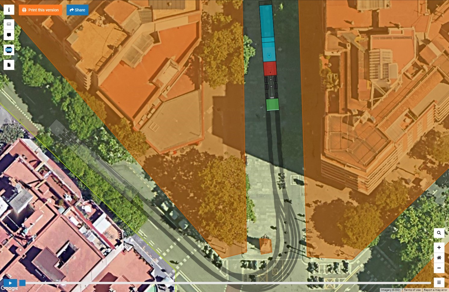
The TruckTrix® is an algorithm1 developed at the Fraunhofer IVI. It automatically determines maneuvers that enable multi-module vehicles to reach a given destination based on digital maps, taking into account their complex vehicle geometry and kinematics. The digital maps contain information about trafficable areas and obstacles to be avoided. The TruckTrix® algorithm is based on the A-Star (A*) graph search approach with special cost-functionalwhich is responsible for path optimization. Furthermore, we have provided several methods for path post-processing that help create well-drivable trajectories for vehicles with complex geometries as well as for highly automated vehicles.


1 TruckTrix® Paper 2013: http://publica.fraunhofer.de/dokumente/N-300510.html

2 TruckTrix® Paper 2021: http://publica.fraunhofer.de/dokumente/N-642541.html

TruckTrix® Path Tool

The TruckTrix® Path web service is based on the TruckTrix® algorithm and can be accessed by any application all over the world via a standard API.

The advantages of the TruckTrix® Path tool are:

  • Web service provides optimal path planning for vehicles to any desired destination
  • Takes into account complex vehicle geometry and kinematics
  • Considers precise maps of critical narrows
  • For most requests, the calculation can be performed within several seconds or minutes

Application Examples

  • In the HeavyGoods project, TruckTrix® Path is used to check passability and to create collision-free trajectories for single or multi-unit vehicles through critical narrows. 
  • The helyOS® control tower framework can use TruckTrix® Path as an external plugin service for path planning in logistics centers, seaports, airports, etc.

Who Shall Use it

Thanks to its web interface with access to a standardized API, TruckTrix® Path can be used by any other external project in need of collision-free path planning for vehicles with complex geometries.

How to Use it

The algorithm is implemented in the TruckTrix® Path tool, which runs permanently on a Fraunhofer server and can be accessed via web interface using a standard service API.

The request should contain:

  • the vehicle geometry,
  • the digital map,
  • the starting position of the vehicle on the map and
  • either the vehicle's target position or a spline trajectory to be driven by the vehicle exactly. In both cases, TruckTrix® Path will calculate the corresponding path.

helyOS® & DriveLab

The TruckTrix® Path tool is used as a plugin microservice in the helyOS® control tower framework for mobile machines. helyOS® requires the TruckTrix® Path planner for any use case where automated vehicles are to fulfill a mission in a closed area. This can be a logistics center, a seaport, an airport, etc.

helyOS®, like TruckTrix® Path, is also part of the DriveLab project in which an automated model truck drives on a projected map.